Are School Districts Gerrymandered?
School district boundaries decide two things at once: which children go to school together, and whose property taxes pay for it. Changing district boundaries is politically unpopular and doesn’t happen with enough frequency and intensity to conduct routine analyses on changing district boundaries. Recent advances in GIS have allowed for an increased volume of research to optimizing district boundaries, but often these studies merely reduce the number of school districts in a state, which inevitably shows less segregation and less fiscal inequity.
This leaves the current school district maps relatively unexamined. Segregation occurs substantially between-district, but it’s difficult to separate the notion that school districts simply mirror the segregation of neighborhoods from the notion that school districts themselves act as segregation engines.
Looking at a single map, or a single segregation measure, there is no way to separate the two. My research borrows a tool from the study of legislative gerrymandering to pull them apart. Using Markov chain Monte Carlo methods, I generate 14.4 million alternative ways of dividing Pennsylvania into 500 school districts, building each one from the same 10,173 census block groups and leaving every child exactly where they live.
Scrambling school district boundaries millions of times yields a distribution of possible maps to compare the current state of affairs of school districts. Unlike legislative districts, school districts have no legal parameters: no standards for population equivalence or rules for contiguity, and certainly no mandates to the amount of wealth surrounding each child. But legislative redistricting tools require these kinds of parameters, so I forced Pennsylvania’s randomized counterfactual maps to take on the same population distribution of its current maps by preserving the same ratio of large and small school districts statewide.
Below, you can see an example of a few of the randomized maps.
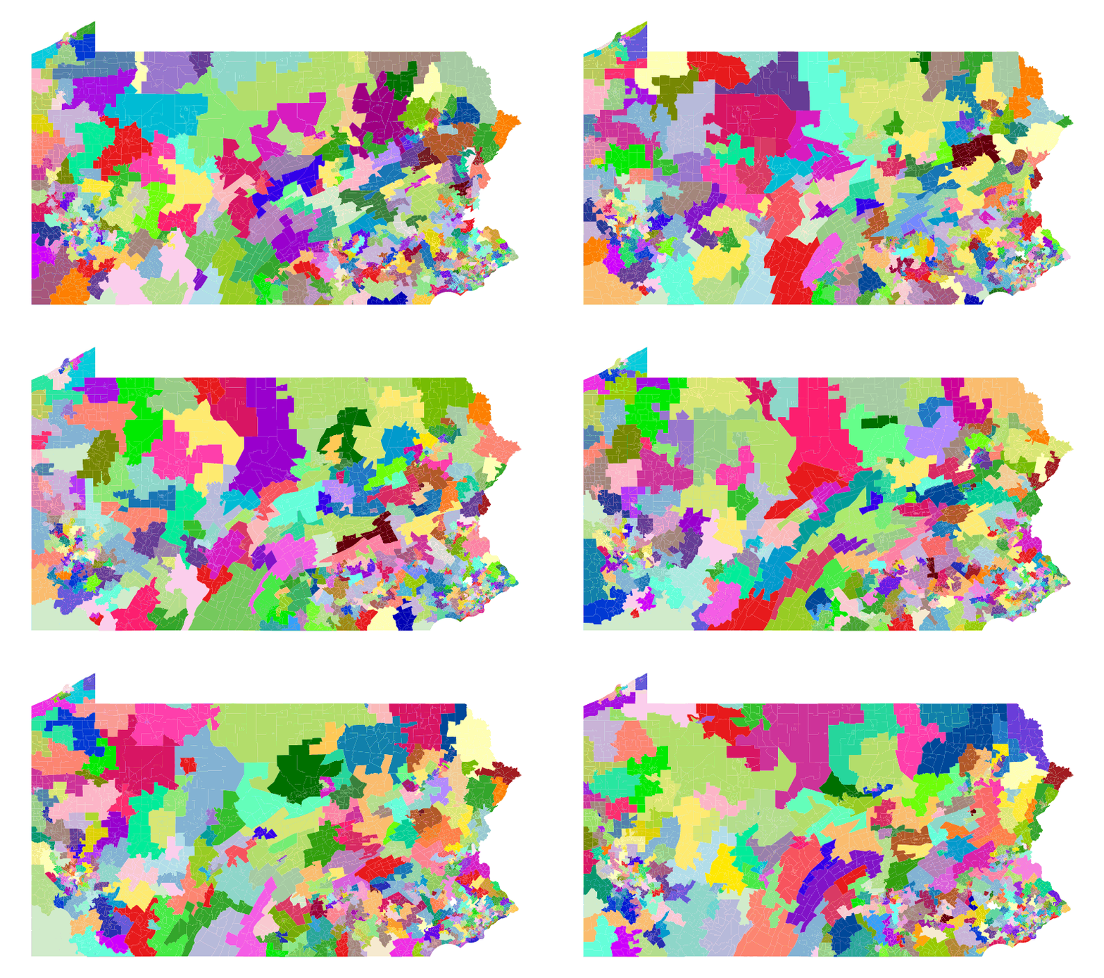
Randomizing Pennsylvania’s school district boundaries
The full findings will be made available in an upcoming whitepaper entitled “The Contribution of School District Boundaries on Segregation: A Gerrymandering Analysis of the Child Population and Educational Resources. For an analysis of how random redistricting can demonstrate the nature of Pennsylvania’s rural school district lines, see my book chapter in The Rural Blindspot by Emerald Publishing.
Four Pennsylvania school district shapes